Watch as Storm Jocelyn hits Sunderland's coast
and live on Freeview channel 276

Sunderland looks set to miss the worst of Storm Jocelyn, although the Met Office still has a yellow weather warning in place for the city.
Rain is expected for much of the remainder of Tuesday, January 23 with gusts of wind up to 54mph in the early hours of Wednesday.
Advertisement
Hide AdAdvertisement
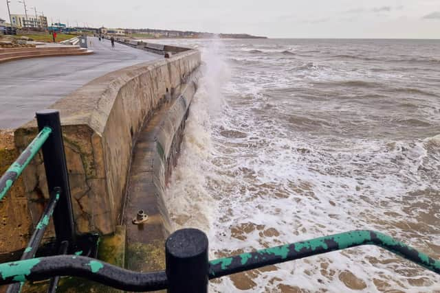
Hide AdAt high tide on Wednesday the waves crashing into Seaburn appeared no bigger than average. But everyone, particularly travellers, is urged to stay safe and not be fooled into a false sense of security.
In other parts of the country there has been flooding, travel disruption and falling trees. Storm Jocelyn comes almost immediately after Storm Isha left two people dead - in Falkirk and County Londonderry.
Wearside will have a highest temperature of 12C. Wednesday is expected to be mostly dry and sunny here. However, with temperatures of around nine degrees, though it will feel more like five degrees with the windchill factor.
Comment Guidelines
National World encourages reader discussion on our stories. User feedback, insights and back-and-forth exchanges add a rich layer of context to reporting. Please review our Community Guidelines before commenting.