Weather warning for Sunderland: This is how long Storm Diana will cause disruption across the North East


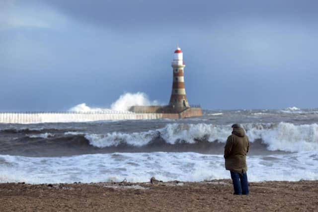
The Met Office has issued yellow weather warnings for wind in the North East after gales caused transport delays and disruption across Ireland and the North West.
Forecasters are warning of potential power failures and loss of life from flying debris as the high winds will continue into Thursday afternoon across most of the UK.

Advertisement
Hide AdAdvertisement
Hide AdTemperatures will be a very mild for this time of year at up to 13C as the gusts are from the South West, which pushes warmer air across the UK.
Conditions are expected to calm down by the end of the week when there will be a return of frosty mornings along with light rain showers.
Today:
Wet and increasingly windy during the morning, with gales likely, particularly over hills and coasts. Rain, heavy at times, giving way to brighter conditions but a few blustery showers in the afternoon, mainly over the hills. Mild. Maximum temperature 13C.
Tonight:
Breezy and unsettled, with clear spells alternating with blustery showers, these heavier and more frequent over the hills. Colder than the previous night. Minimum temperature 3C.
Friday:
Advertisement
Hide AdAdvertisement
Hide AdBlustery showers continuing to spread in from the west, some occasionally heavy over the hills but largely sunny to the east. Showers easing overnight. Much colder than Thursday. Maximum temperature 7C.
Outlook for Saturday to Monday:
Cold, locally frosty early Saturday, then cloudy with light rain. Cold and murky on Sunday, with further rain and perhaps fog. Rain and showers on Monday, possibly windy later.