Where is spring, why is it so cold and is this unusual? Everything you need to know about the Arctic blast hitting Sunderland
and live on Freeview channel 276
March 2022 saw pleasant sunny days in the city with temperatures in the second half of the month rising to 18 degrees Celsius, way above this week’s average daytime high of three degrees Celsius, with overnight temperatures plunging to around minus four.
At the end of a long winter, people are yearning for the arrival of spring and so just why are we getting this prolonged spell of cold snowy weather, is it unusual for March and most importantly, is there any sign of spring on the horizon?
Here’s everything you need to know.
What is causing the current cold snap at a time when temperatures would normally be warming up?
Advertisement
Hide AdAdvertisement
Hide AdAfter a fairly mild December and January, and England’s driest February in 30 years, the current cold snap at the onset of what should be spring is an unwelcome sting in winter’s tail.
According to the Met Office the current spell of cold weather is the result of rapid warming high in the earth’s atmosphere, the stratosphere, at a range between 10km and 50km.
Stratospheric warming, as it is known, occurs as a result of a weakening of the polar vortex, a circulation of high energy winds present in the winter high in the stratosphere. If these winds weaken, it allows cold air to descend, allowing the air above to warm rapidly.


This destabilisation can impact on the jet stream causing it to weaken, change position and allow cold northerly air – the current Arctic blast – to sink down to more southerly latitudes, bringing sustained spells of cold weather.
Advertisement
Hide AdAdvertisement
Hide AdThis is also what happened in March 2018, with the infamous Beast from the East. However, cold air alone is not the only ingredient for the current snow, with moisture an obvious essential ingredient.
The UK currently sits on the front-line battle ground between this Arctic air mass, sat over our country, and milder wetter air trying to push in from the south west and the Atlantic. While the cold air mass is currently prevailing, when this moist air hits the cold air mass the result is the formation of snow high in the atmosphere.

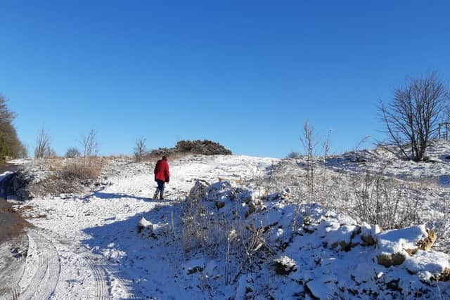
Just how cold has it been?
This week has seen temperatures in Sunderland plunge to a chilly minus four degrees Celsius. The country also recorded its coldest March temperature since 2010 with the mercury plummeting to -15.4 degrees Celsius in Kinbrace in the Highlands of Scotland.
The situation has prompted a Level 3 Amber Cold Weather Action Alert for the whole of England to be implemented by the UK Health Security Agency which will run until 9am on Monday March 13.
Is this weather unusual in March?
Advertisement
Hide AdAdvertisement
Hide AdWhile March represents the start of meteorological spring, snowfall is not unusual, particularly in Northern England and Scotland. According to the Met Office, the likelihood of snow in England is higher between January and March than in December, with snow or sleet falling an average 3.9 days in December, compared to 5.3 days in January, 5.6 days in February and 4.2 days in March.
As the impacts of climate change begin to emerge, some scientists are predicting in the future there will be a greater likelihood of a white Easter than a white Christmas.
Are there any signs that spring is about to arrive?
The Met Office forecast for Sunderland is for temperatures tonight (Friday) to once again plunge below zero with the possibility of sleet forecast for Saturday evening and night.
Temperatures do warm up on Sunday and Monday, reaching highs of 11 and 12 degrees Celsius, but colder conditions then return again from Tuesday onwards with daytime highs of just 6 degrees.
Even looking further ahead, the BBC’s long-range forecast shows that by March 22 and 23, temperatures will still only be peaking at just 7 degrees Celsius.