
Storm Babet in Sunderland latest weather warnings as 50mph winds hit and heavy rain looms

Weather warnings are in place until Saturday lunchtime
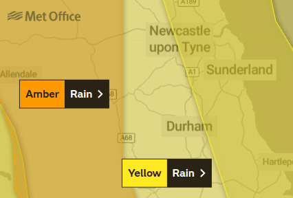

Households and businesses in Sunderland have begun to hunker down as Storm Babet lashes the city.
The Met Office yellow weather warning for heavy rain is now in place until 6am Saturday, October 21.
A yellow weather warning for strong winds is in place from 12noon Friday, October 20, to 12noon Saturday.
Sunderland City Council is urging people to stay at home if possible.
City leaders have cancelled the Festival of Light in Mowbray Park until after the weekend, and other events around the North East are also off.
Rain forecast
Heavy rain is now forecast to begin in Sunderland at 2pm and continue through the night and into the early hours, finally easing off about 7am on Saturday.
Saturday will then remain wet until the afternoon, and is forecast to dry up around 1pm with Sunday due to be dry with some sunny spells.
Wind forecast
Strong winds in Sunderland are due to be above 50mph, and are set to peak at around 56mph in Sunderland at around 2pm, dropping slightly into the high 40s for the rest of the day.
They are forecast to rise back about 50mph overnight, but then steadily drop in the early hours and be into the 20s by 8am and be below 20mph by 3pm.
Sunderland is, however, less affected than other parts of the UK, with red warnings in place for parts of Scotland and amber warnings in place as close as west County Durham and west Northumberland.