Sunderland weather: Gloomy bank holiday ahead - Met Office predicts cloudy weather and possible thunderstorms

and live on Freeview channel 276
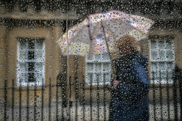
The recent bad weather that has plagued the North East recently is set to continue over the upcoming May bank holiday which will no doubt be bad news for thousands of Sunderlandresidents set to enjoy the day off.
Despite seeing a spike in the temperature on May 1, with a high of 14°C, the Met Office has forecast clouds all day from sunrise at 5:27am, until sunset at 8:40pm. However, people in the area can still somewhat enjoy the day, with no rain set to fall.
Advertisement
Hide AdAdvertisement
Hide AdThis comes just weeks after many parts of the UK experienced a ‘soft heatwave’ over the Easter weekend which brought sunny skies and warmer weather. But, towards the tail end of the month, temperatures have dropped and the sun has disappeared in the North East.
The upcoming weekend (April 29 & 30) will be the worst weather the area will see over the period, as thunderous weather is a real possibility, with light rain expected to arrive on Sunday afternoon.
For the weekend and Monday, the Met Office says: “Mostly cloudy over the next few days with some showery outbreaks of rain, these perhaps heavy and thundery at times, especially on Sunday. Generally mild with light winds.”
As we move into next week, and May itself, the weather will ease up, with constant clouds hanging above. The high temperature will stay above 10°C all week, dropping as low as 6°C on Tuesday (May 2) night.
Advertisement
Hide AdAdvertisement
Hide AdThe UK long range weather forecast from the Met Office, which covers the May bank holiday and the extra bank holiday courtesy of King Charles’ coronation, which will fall on May 8 is also available.
The Met Office says: “On Monday, possibly thicker cloud with more persistent rain across the far north, clearing east through the day. Again, low clouds across many parts at first breaking up to showers, possibly heavy and thundery.
“The focus may shift to eastern parts with the south and southwest staying fine and dry. Temperatures still mostly above average, but feeling cooler in the far north and northeast. Later, high pressure is expected to lie to the east of the UK.

“This is likely to bring settled conditions at first, with plenty of warm, dry weather. Frontal zones may bring some rain and low cloud especially in the west, but their remnants are more likely to become a focus for showers as they spread across the country. Some of these potentially heavy and thundery.”
Comment Guidelines
National World encourages reader discussion on our stories. User feedback, insights and back-and-forth exchanges add a rich layer of context to reporting. Please review our Community Guidelines before commenting.