Snow, ice and a windchill of -8°C as arctic blast set to hit Sunderland
and live on Freeview channel 276
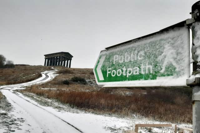
Sunderland is set to be hit by an arctic blast this week with temperatures set to plunge to a chilly minus three degrees celsius and the possibility of snow.
Taking into account the windchill, real feel temperatures are set to be more like a teeth chattering minus eight degrees Celsius.
Advertisement
Hide AdAdvertisement
Hide AdWith sub-zero overnight temperatures and daytime highs struggling to get above freezing, ice and frost is also set to be a problem.

Check out the current forecast for the week ahead according to the Met Office.
Monday is forecast to be a sunny but very cold day.
The temperature is set to peak at around one degrees celsius during the mid-afternoon before quickly returning to zero by early evening and an overnight low of minus two.
Gusty North Westerly winds will make the temperature feel more like minus eight degrees Celsius.
Advertisement
Hide AdAdvertisement
Hide AdTuesday will generally be an overcast but slightly warmer day with temperatures rising to a peak temperature of three degrees Celsius at 5pm with temperatures once again falling to freezing by midnight.
Windchill temperatures will feel more like minus six degrees Celsius. The chance of precipitation throughout the day is 10% or less.
Wednesday will start with a 50% chance of snow showers between 6am and 9am. Skies are then forecast to clear to leave a dry, sunny but very cold day. Temperatures aren't forecast to rise above freezing with temperatures plummeting to minus three degrees Celsius by 9pm. North Westerly winds will see a real feel windchill of around minus eight degrees Celsius.
Thursday is forecast to be another sunny, cold and dry day with a 9am temperature of minus two degrees Celsius.
Advertisement
Hide AdAdvertisement
Hide AdTemperatures will rise to a high of one degrees Celsius before once again falling below freezing point by nightfall.
Windchill will see temperatures feel as cold as minus eight degrees Celsius.
Friday will see temperatures start to rise with an early morning high of minus one degrees Celsius rising to four degrees Celsius by mid-afternoon.
Overnight temperatures will remain above freezing. It will generally be a dry and sunny day.
Weather Warning
Advertisement
Hide AdAdvertisement
Hide AdParts of the North East have been issued with a Yellow Weather Warning for snow and ice. The warning is currently in place from midnight until 11.59pm tomorrow (Tuesday).
The warning issued by the Met Office warns of the risk of injuries from slips and falls and travel disruption on the roads and with rail and air services.
The weather warning currently extends across the region just to the north of Sunderland.
Comment Guidelines
National World encourages reader discussion on our stories. User feedback, insights and back-and-forth exchanges add a rich layer of context to reporting. Please review our Community Guidelines before commenting.