Met Office yellow weather warning for Sunderland: Snow & ice expected in north - how long cold snap will last

and live on Freeview channel 276
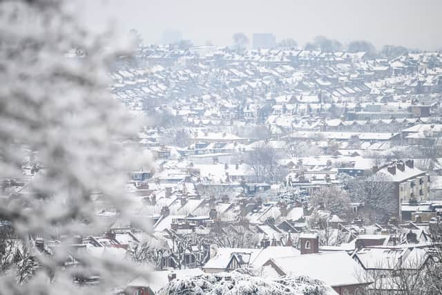
A fresh weather warning for Sunderland has been put in place by the Met Office, days after the cold snap was predicted to end. This comes as the north in particular has been hit with snow and sub zero temperatures throughout March.
Despite the harsh weather as winter winds down, this weather follows the fifth mildest February on record and the driest for 30 years, with some areas of the UK reaching temperatures as high as 12C.
Advertisement
Hide AdAdvertisement
Hide AdLast Monday (March 6), all regions of England were under a level 3 cold weather alert issued by the UK Health Security Agency (UKHSA). This was extended until 9am on Monday (March 13).
The weather alert for snow and ice affecting Sunderland is in place from 5pm this evening and is set to end at 10am on Tuesday (March 14). The initial weather warnings in the area were meant to end last week, but have been extended.
A spokesperson for the Met Office said: “Rain, sleet and snow followed by ice is likely to cause some impacts to travel.” On Tuesday (March 14), the temperature will go below 0C, but will bounce back to around 8C the day after, with weather around the UK expected to improve.
With a yellow weather warning for snow and ice, you can expect:

- Some roads and railways likely to be affected with longer journey times by road, bus and train services
- Some injuries from slips and falls on icy surfaces
- Probably some icy patches on some untreated roads, pavements and cycle paths
Comment Guidelines
National World encourages reader discussion on our stories. User feedback, insights and back-and-forth exchanges add a rich layer of context to reporting. Please review our Community Guidelines before commenting.