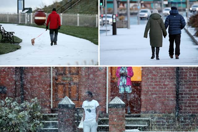
More snow and ice set to hit Sunderland with three-day weather warning issued by Met Office
and live on Freeview channel 276
The Met Office has issued a three day Yellow Weather Warning for the city with wintry weather set to potentially disrupt travel and increase the risk of accidents and injuries.
Despite still being in meteorological autumn, the city awoke this morning to a thin blanket of snow and there could be more on the way with the potential for further snow showers over the next few days and overnight temperatures plummeting to below zero.
Advertisement
Hide AdAdvertisement
Hide Ad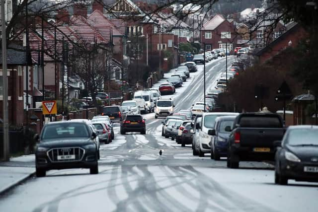

The first weather warning comes into effect this evening (Wednesday November 29) at 5pm and extends to 11am on Thursday morning.
Another yellow warning from the Met Office has then also been issued, starting at 5pm on Thursday evening and ending at 11am on Friday December 1 - the first official day of winter.
The warnings are for snow and ice, with the risk of “further wintry showers, leading to icy patches developing".
The Met Office warns of the danger of icy patches on roads, pavements and cycle paths with the likelihood of “longer journey times by road, bus and rail services”.
Advertisement
Hide AdAdvertisement
Hide AdWintry conditions will also lead to an increased risk of “injuries from slips and falls on icy surfaces".
Despite the warnings there is more sleet than snow in the hourly Met Office forecast breakdown for Sunderland.
This afternoon (Wednesday) will see spells of rain, with sleet forecast between 5pm and 7pm.
Thursday will see snow and sleet showers between 6am and 1pm, with the probability ranging between 30% and 70%. Intermittent snow and sleet showers are then forecast between 4pm and 10pm, with a 60% chance of heavy snow showers at 11pm.
Advertisement
Hide AdAdvertisement
Hide AdThese heavy snow showers are then forecast to continue in the early hours of Friday morning (December 1), gradually turning to sleet.
The current forecast is for dry weather to move in for Friday afternoon.
It will remain cold across all three days with temperatures peaking at just three degrees Celsius and falling to a low of minus three degrees Celsius on Friday night.
The weekend currently looks to be cold and dry with a maximum temperature of just two degrees Celsius.
Comment Guidelines
National World encourages reader discussion on our stories. User feedback, insights and back-and-forth exchanges add a rich layer of context to reporting. Please review our Community Guidelines before commenting.