Ice warning issued for North East as some areas warned to get ready for heavy snow
and live on Freeview channel 276
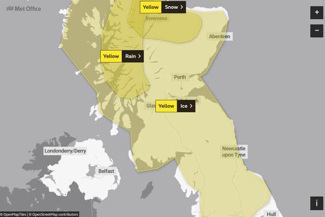
The alert runs from 3pm today, Monday, January 11, until 11am tomorrow and covers the whole region, as well as the North West of England and most of Scotland.
The warning states: “Rain and snow will clear southwards later Monday and overnight into Tuesday, with a rapid freeze following.
Advertisement
Hide AdAdvertisement
Hide Ad"Some hilly areas will see a further cover of 1cm to 3 cm snow beforehand.


"Ice will become widespread over northern Scotland from around dusk, much of the rest of Scotland by late evening or the early hours, and across northern England later in the night.”
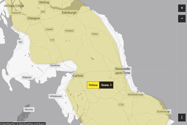
It is followed by another yellow warning for snow, which covers Northumberland, Sunderland and County Durham in its list of locations, although the Met Office map appears to suggest the coast will escape the downfall.
The alert states there is a chance of a period of heavy snow across this region; should it occur it is likely to cause significant travel disruption as well as a small chance of travel delays on roads with some stranded vehicles and passengers, along with delayed or cancelled rail and air travel.


Advertisement
Hide AdAdvertisement
Hide AdThe forecasters say there is a slight chance that some rural communities, mainly those at higher elevations, could become cut off and that power cuts will occur and other services, such as mobile phone coverage, may be affected
The warning, which runs from 5am on Wednesday, January 13, until 9pm the next day, says: "Heavier snowfall is more likely above 150 metres, where 5cm to 15cm of snow may accumulate, and possibly as much as 30cm of snow in a few locations.


"At lower levels 2cm to 5 cm may accumulate but there remains a possibility that milder air makes more inroads, with the snow turning back to rain more widely, in this case snowfall would largely be restricted to the highest ground.
"A brief period of freezing rain, which would bring areas of ice, is possible in the western, especially south-western, part of the warning area on Wednesday morning.”
