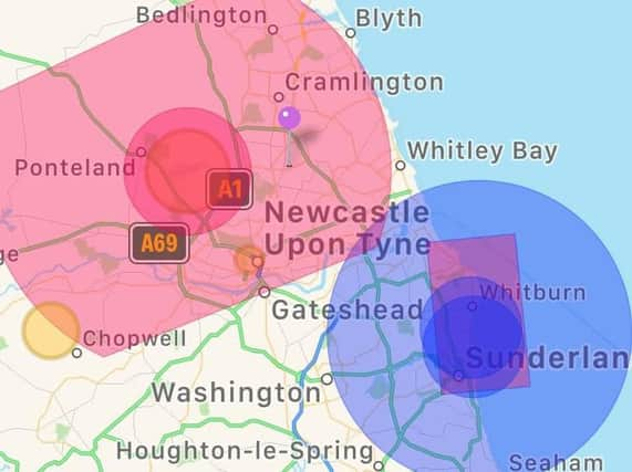
Police reveal airspace restrictions for drones ahead of Sunderland Airshow


Northumbria Police is calling on those with drones to observe the "drone code" and have released a map showing where airspace is restricted over the next three days.
Northumbria Ops Support tweeted: "Additional Airspace restrictions in place due to @SunAirshow Abide by #dronecode
Advertisement
Hide AdAdvertisement
Hide Ad"More information available @NATS or download @NATS Drone Assist App @UK_CAA #flysafe #AirportPolice."
Hundreds of thousands of people are expected to visit Sunderland seafront to see a packed programme of flying displays, which run until Sunday.