Further warning of severe winter weather along North East coast


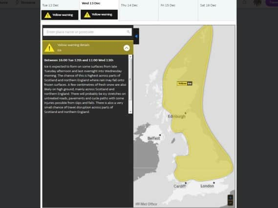
The yellow alert covers a period from 4pm today until 11am tomorrow.
"Ice is expected to form on some surfaces from late Tuesday afternoon and last overnight into Wednesday morning," it says.
Advertisement
Hide AdAdvertisement
Hide Ad"The chance of this is highest across parts of Scotland and northern England where rain may fall onto frozen surfaces.
"A few centimetres of fresh snow are also likely on high ground, mainly across Scotland and northern England.
"There will probably be icy stretches on untreated roads, pavements and cycle paths with some injuries possible from slips and falls. There is also a very small chance of travel disruption across parts of Scotland and northern England.
A statement from the Chief Forecaster's office adds: "A band of rain with some snow (this mostly on hills) will reach western Scotland and Wales on Tuesday afternoon and move quickly eastwards across all parts through the evening and overnight.
Advertisement
Hide AdAdvertisement
Hide Ad"Whilst a brief spell of snow is likely, mostly on high ground in the north of the yellow area, the main hazard is likely to be icy surfaces where rain falls onto frozen ground.
"This risk is greatest across parts of Scotland and northern England where the impacts could locally be greater than elsewhere.
"Temperatures may then rise a little for a time overnight before falling again by Wednesday morning as cloud clears, so ice remains likely. In addition, some wintry showers may affect western Scotland on Wednesday morning."